The Bing Maps team has been working hard this winter and have added some very useful features. So far this year the team has announced many improvements in geocoding and routing, as well as a an open source Fleet Tracking solution. Here are some other exciting things the Bing Maps team has been working on.
Bing Maps V8 Web Control Update
After being on a holiday code freeze, the Bing Maps V8 Control saw two updates, one in January and the other in February. The January update added a new feature called Configuration Driven Maps. Configuration driven maps allow you to quickly and easily create a map using your data with little to no coding required. Instead, create a JSON configuration fill that specifies the data sets you want to render along with some map options and then easily generate a map from this. Besides providing a minimal coding option for creating map apps, configuration driven maps are great for creating reusable map apps which are data driven. Documentation | Try it now
The February update added support for truck routing into the directions module. This allows you to calculate routes which take truck attributes such as weight, cargo type and vehicle dimensions into consideration, while also providing most of the existing features in the directions module such as an input panel and nicely formatted turn by turn directions. Draggable routes are not currently supported for truck routing but are planned. Try it now
Bing Maps V8 Code Samples Project
The Bing Maps V8 has a very useful interactive SDK which is a great place to learn the basics of how to develop with the API. In addition to this, last year the team released an open source project which includes more in-depth code samples. Nearly any sample we create to help a developer is added to this project. There are now over 240 code samples. Check out the GitHub Project or view the Live Code Samples site. Here are a few of the new samples:
Select Pushpins with an Isochrone
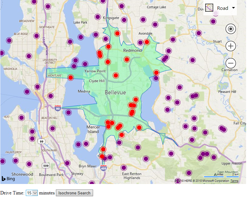
This sample combines the new REST Isochrone API with the Spatial Math module in Bing Maps V8 to show how data can be easily filtered based on drive time. Try it now
Generate Convex and Concave Hulls
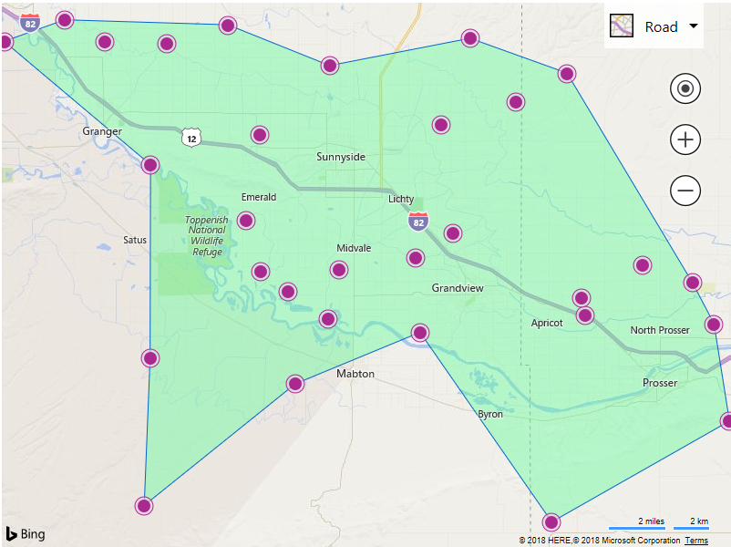
This sample shows how to use the Spatial Math module to generate convex and concave hulls around data. Convex hulls generate a polygon which is similar to wrapping your data with an elastic band. A concave hull is like wrapping your data with shrink wrap and vacuuming out the air to pull in the sides to create a polygon, which better represents that area in which the data covers. Try it now
Snap Drawing to Shape
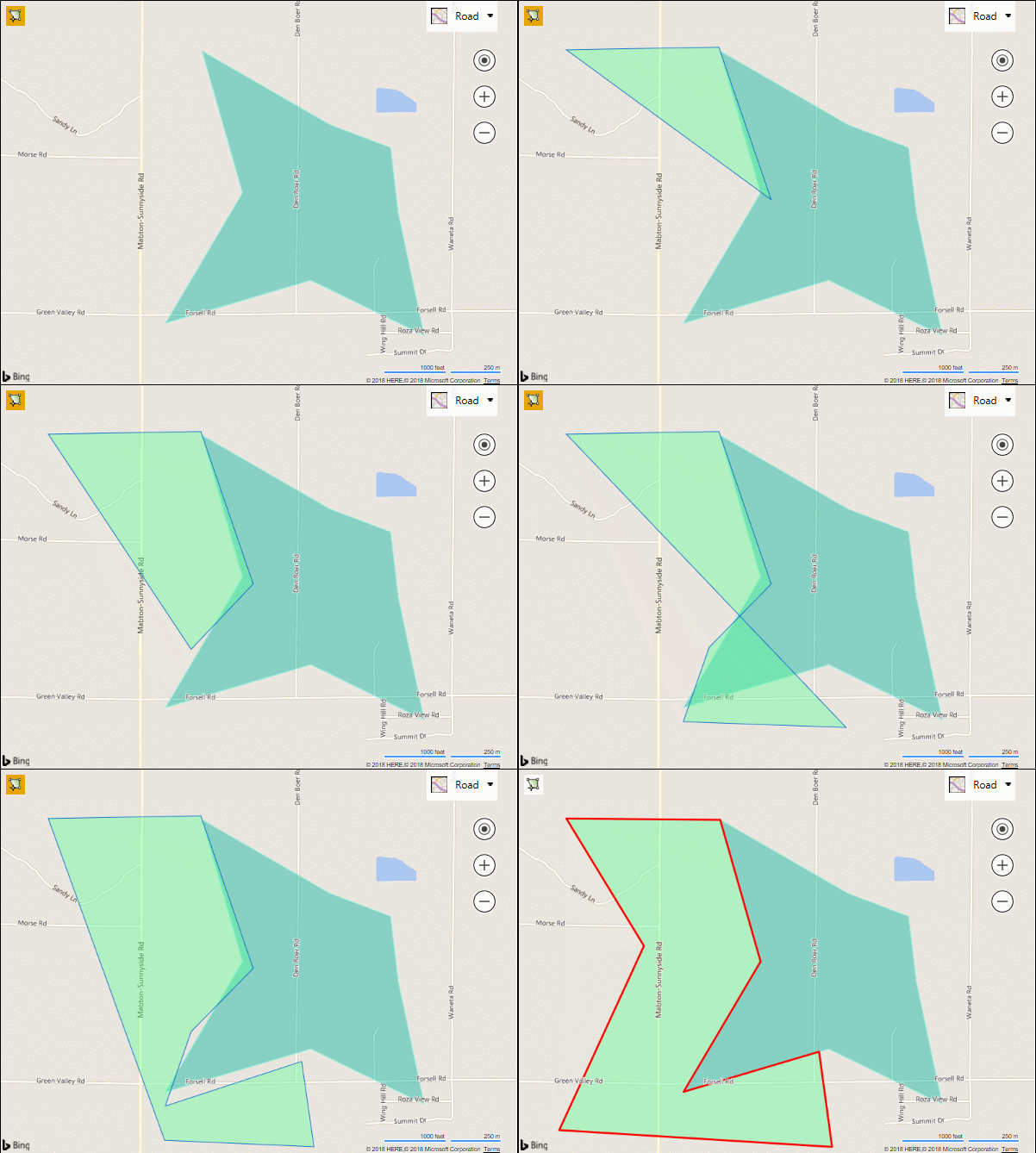
This sample loads a map with a polygon on it, you then draw a polygon that has edges near the existing polygon and when you are complete, it will snap the edges together to create a seamless edge between the two polygons. This is very useful if you want to be able to draw territories on the map. Try it now

New REST Service API’s Update
In December the Bing Maps team launched three new REST APIs; Truck Routing, Isochrone, and Snap to Road. Since then, the team has added support for asynchronous truck routing and isochrone requests, thus allowing for longer routes and large isochrones to be calculated. Additionally, the origin coordinate used to calculate an isochrone is now also returned in the response. Find out more about the new API’s here.
Bing Maps .NET REST Toolkit Update
Just over a year ago, the Bing Maps team released the Bing Maps .NET REST Toolkit as an open source project GitHub. This project makes it very easy to use the Bing Maps REST services in .NET and can significantly reduce development time while also ensuring that best practices are used. In additional this it also provides some extend capabilities. Some of the recently added features include:
- Support for the new Truck Routing, Isochrone, Distance Matrix and Snap to Road APIs.
- An extension which adds support for Travelling salesmen waypoint optimizations has been added. It can be used on its own to optimize the order of waypoints. It is also integrated into the route request options, thus allowing you to calculate routes with optimized waypoints with only one additional line of code required in the request. Find out more here.
- Added options for setting proxy settings and QPS limits.
- Support for .NET Standard 2.
A NuGet package is available for this library making it easy to add this library to your project. Find out more on the GitHub project page.


