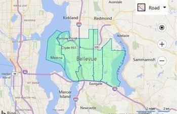
While postal delivery areas data is probably used for sending out mailers to a specific neighborhood to target specific demographic groups and prospect for customers. I love when my mailbox is full of recyclables, Not! Bing Maps Spatial Data Service actually has quite a bit of data included and here are some samples of how they can be viewed up on a Bing Maps Web control "Virtual Earth" map.
 |
Load Multiple Boundaries GeoData This code sample shows how to request the boundaries for 5 zip codes and render them on the map. | |
 |
GeoData Choropleth Map This sample shows how to create a simple choropleth map which retrieves boundary data from the GeoData API in the Bing Spatial Data Services. | |
 |
GeoData Search Boundary If the search location has an entity type value that is supported by the GeoData API, a boundary will be requested and if available, displayed on the map. |

