Successful businesses have to make hundreds, if not thousands, of decisions daily to optimize sales efficiency. What kind of route should your agents take to reduce fuel costs? Or, what location offers the best benefits for a potential expansion? Bing Maps API answers these questions and more with intelligent sales territory mapping.
Let’s go through a few scenarios where sales territory maps can make a real difference.
Designating better territories
Location intelligence involves processing geographic data to produce the actionable insight that drives effective decision-making. This is difficult to do well simply because of the sheer amount of data that goes into arriving at the correct decision. This could be anything from crunching the census numbers for a particular neighborhood to calculating the time it would take for an agent to travel from one side of the area to another.

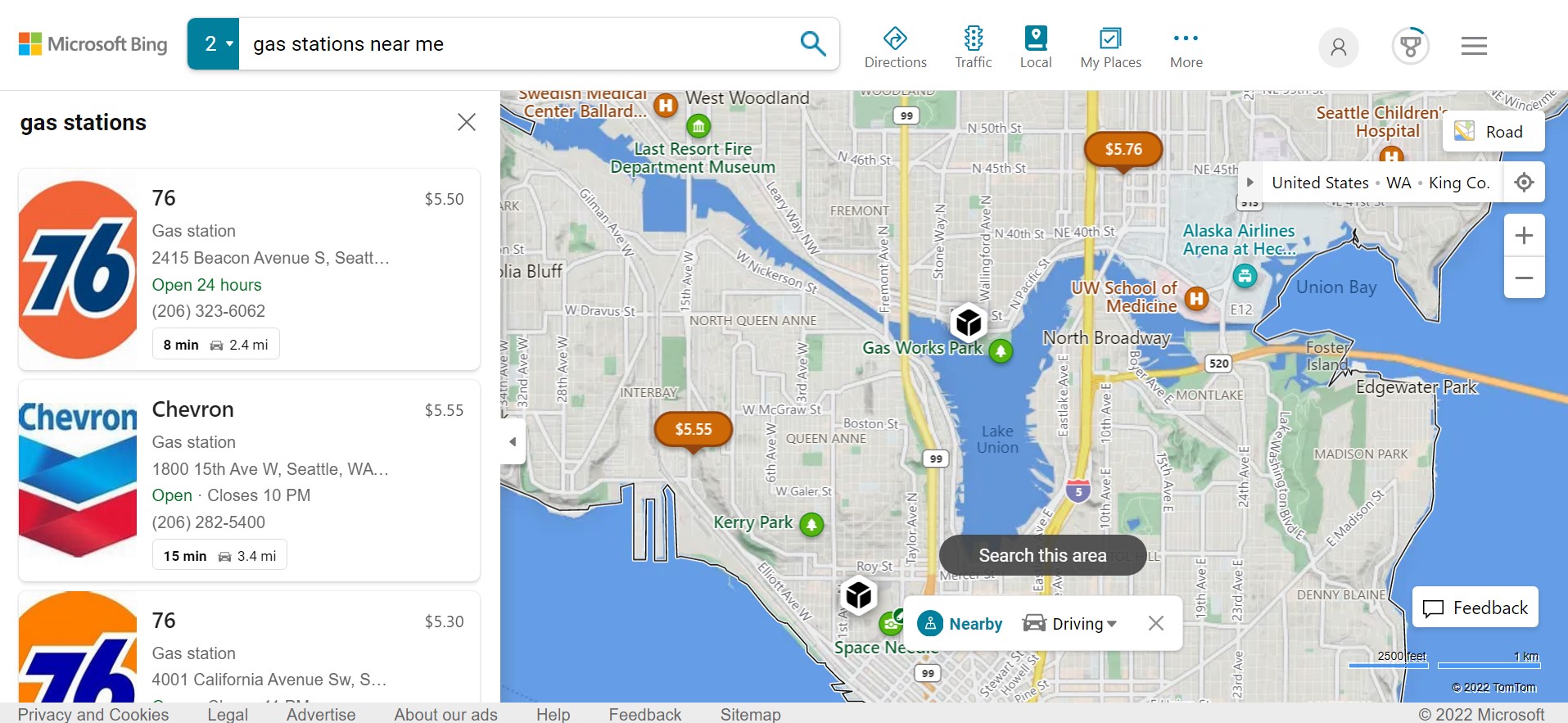
The Bing Maps Location Recognition API gives you a headstart in creating a sales territory map, using high-powered reverse geocoding and spatial data mapping to address business needs. This means that geographic coordinates will be converted into text-based addresses that are then used to source a list of nearby points of interest using the Local Search API.
There’s tons of room for flexibility here. Developers can specify either a radius or bounding box to search in, and the API also supports free-form text search so both users and businesses can use it in a way that feels natural.
Sales teams working on territory mapping will find this to be an invaluable feature for logistics and marketing. You can map out the locations of local competitors in seconds, while also accounting for rest stops and fuel stations that agents will require on the way. This feature is the foundation of an effective logistics app since we can now create an effective route leading through these points of interest.
Adding demographic data
Static information about points of interest is a great place to start, but businesses need a mix of dynamic and static data for sales territory maps. Demographic data is a crucial part of these maps as it provides highly valuable real-time context. A location surrounded by rest stops and connected to multiple transport corridors might seem appealing at first glance, but it isn’t going to do much good for sales reps if it’s sparsely populated.
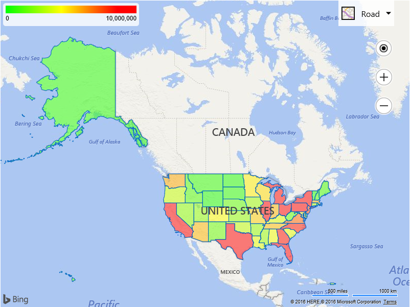
The Bing Maps for Enterprise V8 Web Control allows businesses to carry out sales territory mapping with features like choropleth maps (color-coded boundary maps), Streetside imagery, and heat maps.Instead of manually looking up and entering population numbers for each region, we can instead use V8 to query the latest census data and accurately generate a color-coded map. This reduces the chances for human error that can seep into sales territory maps and also saves a ton of time.

For a detailed tutorial on how to generate a choropleth map (with code samples!) take a look at our census data blog. You can also head over to the Bing Maps V8 Interactive SDK to try it out for yourself with an editable sample.
Minimizing travel costs
Demographic data and local searching are useful for sales territory mapping, but businesses also need a tool that can be used to optimize operations in real-time–preferably one that can be adjusted on-the-fly. The Isochrone API is one such tool that can completely change the way we look at distance mapping.
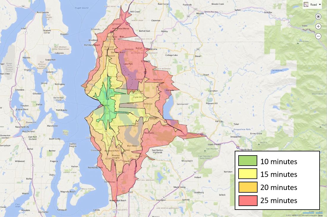
Say you’ve got a sales territory map ready to go with points of interest, agent locations, and gas stations all planned out, and an itinerary comes in with delivery locations spanning an immense area. To complete all the deliveries on time, you’ll need a way to figure out which agents can cover a group of locations in a given time. The Isochrone API solves this dilemma by letting you visualize the exact distance that an agent can cover in a set amount of time–whether that’s on foot, driving, or public transit

This API is customizable to account for any real-time changes that might be required during or before delivery. For example, operators can adjust sales territory maps to avoid certain routes that might involve ferries or tolls, and historical traffic data can also be used to predict traffic on the way. Use our Isochrone API demo to get a glimpse of what sales territory mapping could look like with an API that does the heavy lifting for you.
Case Study: Sales Rep Management With Maplytics
Independent software vendor Inogic used Bing Maps API to power Maplytics, a comprehensive field rep management solution that includes real-time asset tracking, local search, and itinerary optimization. Businesses are now going beyond simple sales territory maps, relying on Maplytics’ robust features to handle their everyday logistics needs. Find out how the team at Inogic built their app, and how Bing Maps API can help you build yours by reading the full case study.
Start optimizing today
Geocode hundreds of addresses in an instant, visualize routes more accurately than ever before, and cut down on travel times and costs with mapping that keeps up with your sales team’s needs. Create a Bing Maps API key for free and start building your sales territory map today.
FAQ
What kind of key should I create?
You can create a Bing Maps API key for free if you’re just looking to tinker with sales territory mapping or using Bing Maps API on a smaller scale. Businesses trying to scale up with a larger number of annual billable transactions would benefit immensely from the Enterprise key’s higher transaction limits and dedicated customer support.
Learn more about which key is right for you on our Licensing page.
Can I try the Isochrone API?
Use our Isochrone API demo to get a glimpse of what sales territory mapping could look like with an API that does the heavy lifting for you.
Visit our Routing APIs page for an overview of other unexpected APIs, like Distance Matrix and Snap to Road, that can be leveraged to improve operational efficiency.
Are there other API features that can be useful for sales teams?
Operators creating a sales territory map will find the Multi-Itinerary Optimization API useful when working with a large number of agents and waypoints. The API can be used to reduce costs by finding the most efficient route that runs through a set of locations, while also accounting for multiple shift schedules.
Visit our Logistics page for an overview of other APIs that can improve sales team efficiency.

