
Update - August 21, 2018
As announced November and December 2017, the following APIs have moved from preview to general availability:
To learn more about the Fleet Management APIs, go to our website. Also, if you have questions or want to share feedback, connect with the team on the Bing Maps Forum.
Last year at //Build 2016 we launched the preview of our Bing Maps v8 control and this year we have even more news for you. It is with immense pleasure that we can announce not 1, not 2, not 3, not 4, but 5 new services for you – and that is in addition to new features and enhancements we brought to our existing services. Let’s recap:
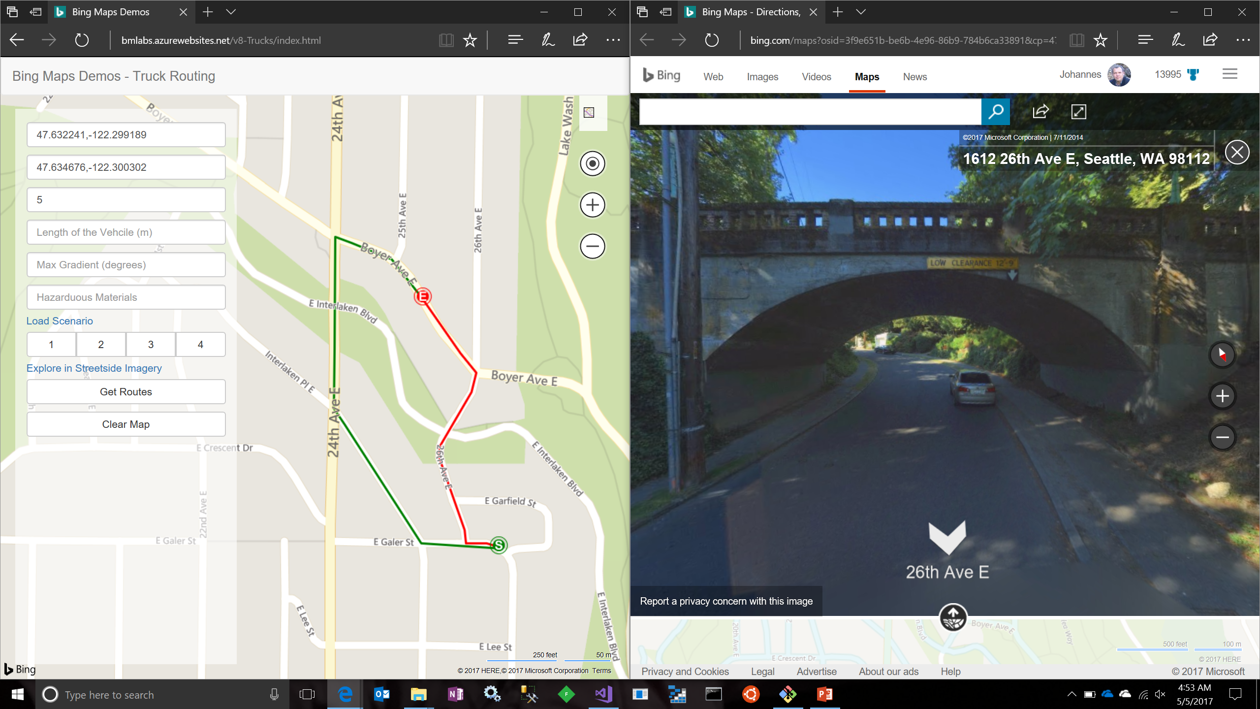
New truck-routing service
Project “Johannesburg” previews a new truck-routing service for professional transportation. Long, wide or heavy vehicles or those transporting hazardous materials may not be able to leverage the same routing service as standard vehicles. Speed limits are different, a bridge to pass under might be too low, one to cross might not support the weight, the turning radius might be too small or the incline too high. Project “Johannesburg” takes into consideration truck attributes and preferences, such as avoiding strong crosswinds and grounding risks.
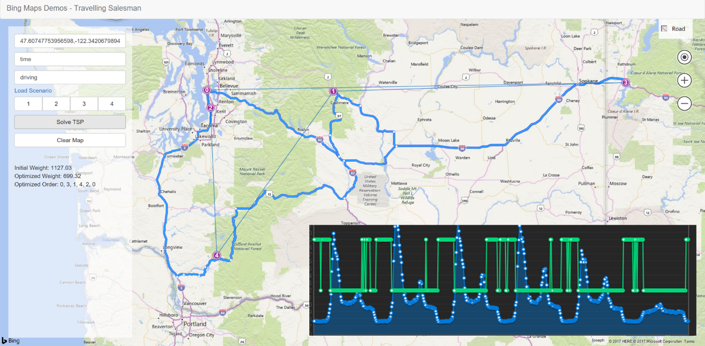
Distance matrix API advances
Project “Abu Dhabi” previews an advanced implementation of a distance matrix API. Calculating travel times and distances in many-to-many scenarios is often addressed through such distance matrix APIs. Project “Abu Dhabi” goes a step further by optionally including a histogram of travel times considering a time-window and the predicted traffic. We also demonstrated how to solve the “travelling salesman problem” with project “Abu Dhabi”. If you need to optimize several stops for your deliveries for your customer service or you next bar crawl, project “Abu Dhabi” is right for you.
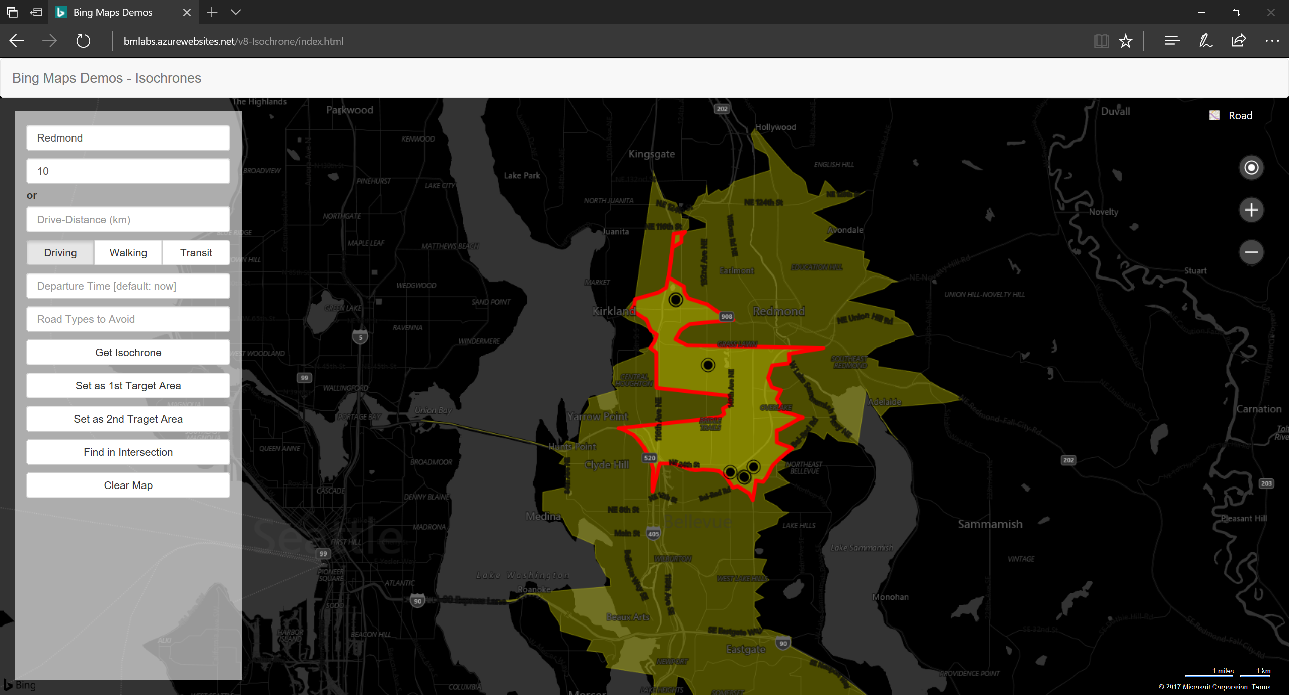
Time-specific isochrones
Project “Nanjing” provides time-specific isochrones for the most accurate search across time and space. Isochrones describe the area that can be reached given a mode of transportation and predicted traffic at a given time of day. Using isochrones, one can answer questions, such as “Where should I live if I don’t want to commute more than 45 minutes?” or “What service engineer can make it to the customer in the next 45 minutes?”.
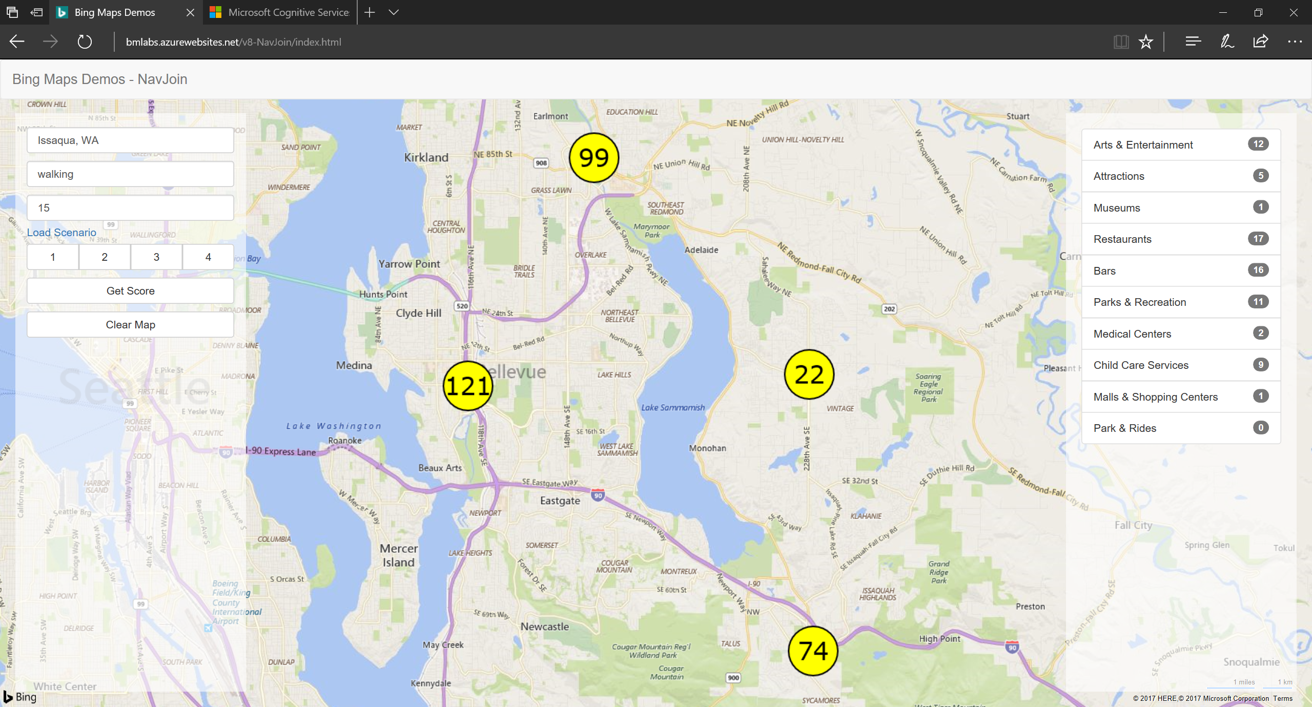
Location attractiveness scoring
Does it matter to you how many cinemas, bars, theaters, parks or other places are near you? If so, Project “Wollongong” is right for you. It implements an API that allows you to provide a score for the attractiveness of a location based on the number of amenities, proximity to public transit stops or other criteria. You can search by time or distance and also take into consideration the predicted traffic at the time that matters most to you.
These new APIs are available in preview immediately on the Cognitive Services Labs website and we welcome your feedback on User Voice for:
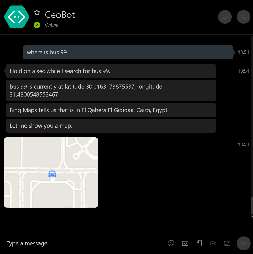
Vehicle tracking solution for small to medium teams
With Project “Hurghada” we previewed a vehicle tracking solution for small to medium sized teams. Through a companion website, you can deploy the solution into your own Microsoft Azure subscription and leverage a mobile application for iOS, Android and Windows phones to track your assets. Project “Hurghada” includes trip detection, geofencing and email notifications.
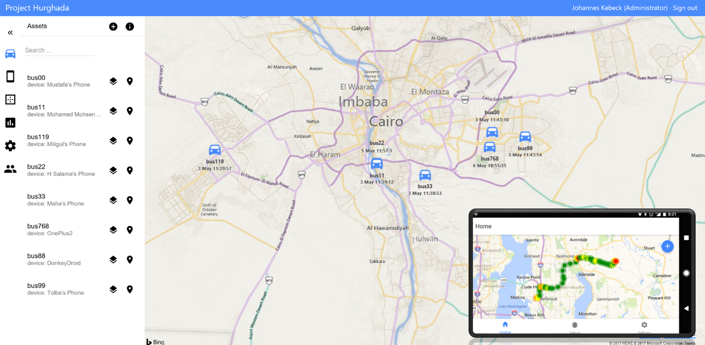
Project “Hurghada” also comes with a set of APIs to deliver the extensibility that some of you might seek. Do you want to build a bot that allows you to find your assets? Project “Hurghada” has you covered. Oh, and it will be fully open source on GitHub and available shortly.
There’s more…
But wait that’s not all. We also brought several improvements to our Bing Maps v8 Control.
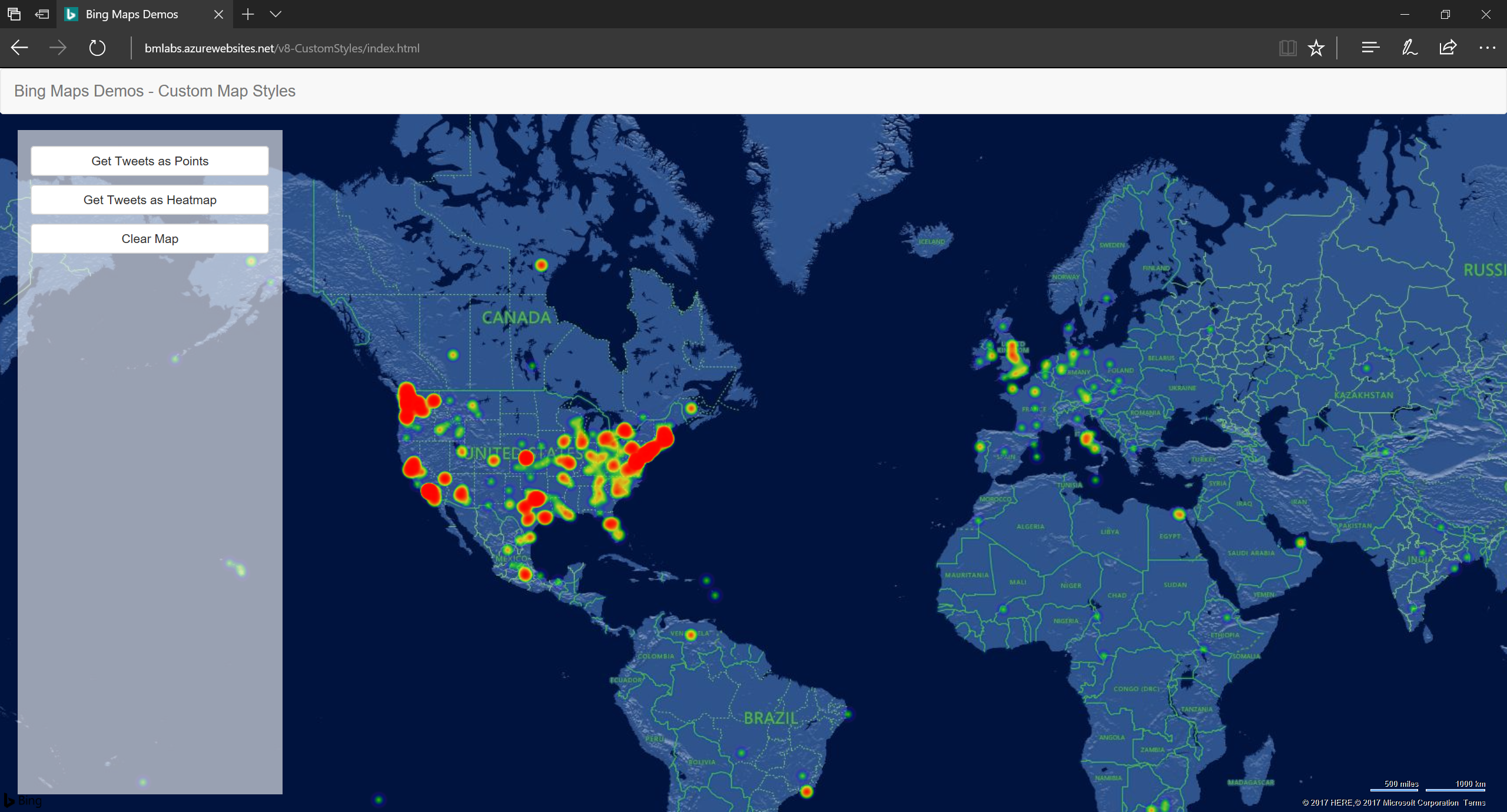
Customizable map styles
First, we introduced fully customizable map styles that allow you to reflect your brand colors on the map and show or hide elements as you see fit. It is the same styling template that you would also use for maps on Windows 10.
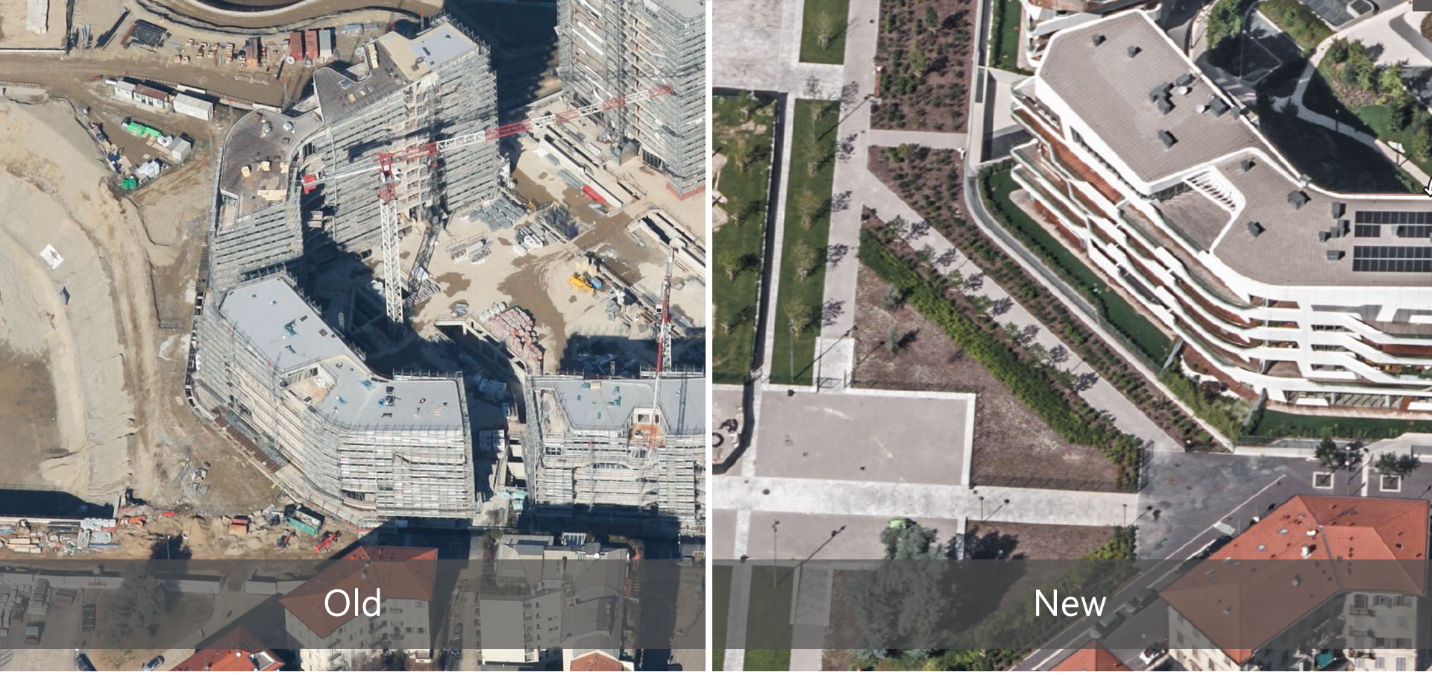
Imagery and more imagery
And then we brought our oblique aerial imagery to the Bing Maps v8 Control as well, alongside some beautiful imagery refreshes.
It was an exciting ride to get all this ready for Build 2017. Please check out the new APIs and features and let us know what you think at User Voice.
- Bing Maps Team
